Forest of Avon
6.1 LCT A: Moors
The map below shows the location of LCAs with LCT A: Moors. - View map full screen
For help on how to use this map click here.
Landscape Character Type description
A flat, low-lying expanse of reclaimed wetlands located predominantly across the west of North Somerset, with outlying areas to the north and south. The Moors LCT is defined by its lowland topography and underlying geology of alluvium and peat.
Within North Somerset, LCT A comprises LCA A1: Kingston Seymour and Puxton Moors, LCA A2: Clapton Moor, LCA A3: Kenn and Tickenham Moors, LCA A4: Locking and Banwell Moors, and LCA A5: Bleadon Moor, as described in the North Somerset LCA (2018), and shown on the mapping provided.
Existing tree and woodland coverage
Woodland cover across the Moors LCT is distinctively low, comprising approximately 1% of the total landcover. The relative absence of woodland is indicative of intensive farmland management and the high water table. It is notably higher (3.5%) in LCA A2 Clapton Moor due to some larger broadleaved woodlands particularly in the Gordano Valley (with woodland dominated by hazel with an understorey of willow, elder and silver birch and occasional conifers). Where woodland exists it typically occurs in small plantations and poplar shelterbelts, with occasional remnant carr woodlands. Trees outside woodlands make up the majority of the canopy cover in this landscape, predominantly as mature hedgerow trees (including willow, oak, and hawthorn) and willow pollards. Remnant traditional orchards on farms also contribute to the tree cover in this open, sparsely wooded landscape.
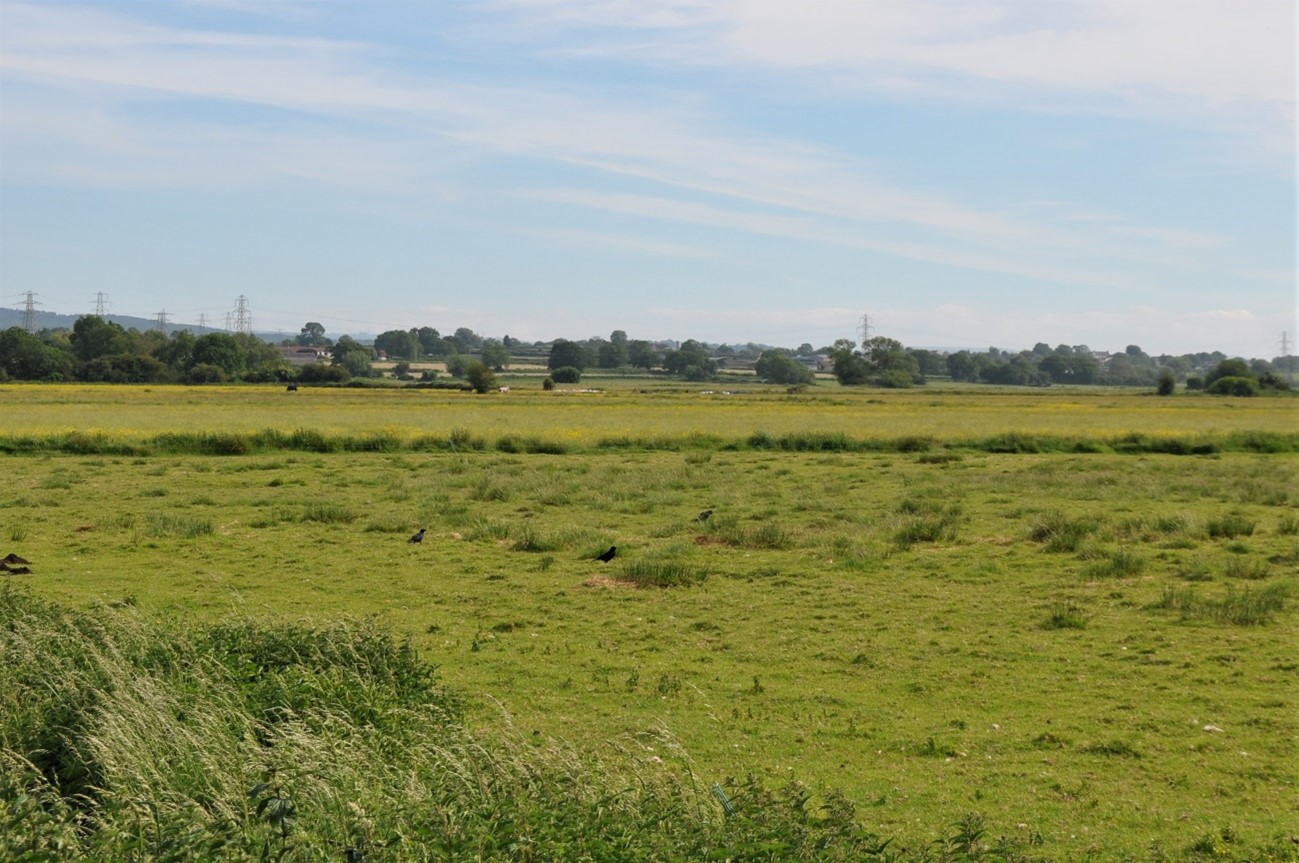
View across Tickenham Moor, the open pastoral landscape punctuated by hedgerow trees (LCA A3).
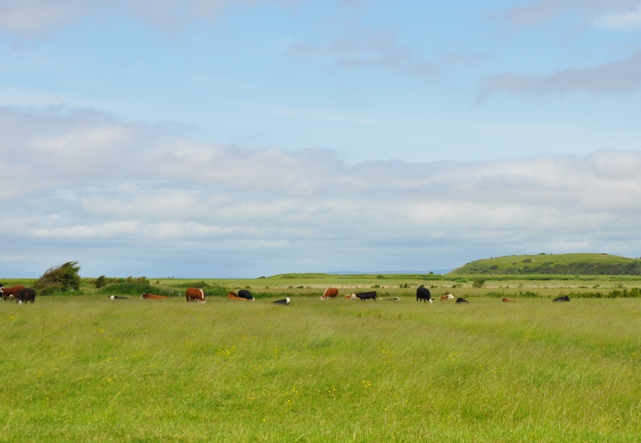
Cattle grazing the open, windswept coastal landscape in LCA A1.
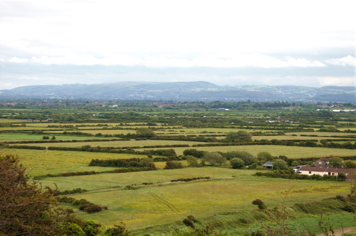
The distinctive field patterns of the sparsely-wooded Moors LCT.
Land cover composition of LCT A
There was an issue displaying the chart. Please edit the chart in the admin area for more details.View and export full results.
Landscape sensitivities
Landform (including scale and pattern)
- An extensive reclaimed wetland, with limited enclosure from hedges and shelterbelts, and only occasional human scale features.
- The low-lying, distinctively flat landform (ranging between 0m and 10m AOD) indicates lower sensitivity to new woodland planting of all sizes.
Field and landcover pattern
- An area of intensively farmed improved pasture defined by intermittent hedgerows of varying condition, rhynes, and ditches, which create a distinctive geometric field pattern. The existing field pattern could accommodate some small-scale tree planting (including the reinstatement of hedgerow trees and willow pollards) which would enhance habitat connectivity and landscape structure.
- A landscape with nationally designated habitats, including extensive areas of floodplain grazing marsh, SSSI-designated lowland mire, and fen meadows at Gordano Valley NNR which would be sensitive to all sizes of woodland planting that could result in loss of habitat and landscape diversity.
- The coastal edge of LCA A1, LCA A2, and LCA A5 lie partially within the Severn Estuary SSSI, SPA, SAC and Ramsar site which is of international importance.
- Solar farms in LCA A1: Kingston Seymour and Puxton Moors and A4: Locking and Banwell Moors introduce modern development to the rural landscape. Small to medium scale woodland planting could help to integrate these features into the landscape.
Historic landscape character
- Distinctive historic field patterns from medieval enclosure of ancient reclaimed inland moors marked by rhynes and open ditches would be sensitive to medium and large scale planting which could mask the historic landscape pattern that is a distinctive feature of the landscape.
- Small traditional orchards associated with farmsteads and older settlements, as well as occasional willow pollards are historically characteristic of this landscape and present an opportunity for enhancement and restoration to reinforce the landscape structure, as well as benefitting biodiversity.
- Scattered medieval moated sites (some of which are Scheduled Monuments) and historic settlements (including Conservation Areas at Loxton, Congresbury, Walton-in-Gordano, Weston-in-Gordano) indicate the long history of settlement in the area, and would be sensitive to new woodland planting that could mask these assets or alter their setting.
Visual character (including skylines)
- The expansive views across the flat moors, only broken by intermittent hedges would be sensitive to new planting of medium size or larger that would enclose the flat moors, and its strong visual relationship with the wooded limestone ridges, including views towards the Mendip Hills National Landscape.
- Mature hedgerow trees, small woodlands and occasional church towers, form landmark features, whilst telecommunications masts and pylons are intrusive vertical features on the otherwise open, undeveloped skylines.
Perceptual and scenic qualities
- A traditional, rural landscape with some attractive features including scattered stone-built farmsteads and churches set within small-scale pasture fields bound by ditches which evoke a sense of timelessness.
- Existing remnant orchards and willow pollards make an important contribution to the rural character of the landscape and would be sensitive to new woodland planting that could mask these features. However, small-scale new woodland planting could enhance landscape structure and habitat connectivity.
- A tranquil landscape with some sense of isolation in places. Major roads, including the M5 (often elevated above the low-lying landscape), pylons within the LCT, and industrial and urban development adjacent to the LCT has a strong visual influence on the landscape. New woodland planting along transport corridors and along urban edges could help to filter views and integrate these features into the landscape.
Assessment of landscape sensitivity to tree and woodland planting
Summary
Small sized woodland creation could generally be accommodated across the LCT. New woodland planting of this scale could reinforce the existing landscape structure of hedgerows with hedgerow trees, and complement and extend the existing pattern of small blocks and linear shelterbelts. Small-scale tree planting could enhance habitat connectivity between the aquatic habitats of the rhynes, and existing woodland and grassland habitats. Historically this landscape has supported small-medium sized carr woodlands (now predominantly found in the Gordano Valley (LCA A2) and traditional orchards, which could be reinstated to enhance landscape and habitat diversity, as well as providing landscape resilience to the impact of climate change, including sea level rise and increased frequency and intensity of flood events.
Medium sized woodland is not typical of this LCT. This landscape would be more sensitive to new woodland planting of this size, which could mask the distinctive historic field patterns defined by rhynes and ditches. There may be occasional opportunities for new medium sized woodland planting including wet woodland belt to be used to screen industrial development at Portbury, help to integrate residential development on the edges of Clevedon and Weston-Super-Mare, and soften the impact of motorway infrastructure, pylons, and Solar PV developments (in LCA A1 and LCA A4).
There are currently no large sized woodlands within this LCT. The introduction of woodlands of this size would be discordant with the existing woodland pattern and has the potential to mask characteristic landscape features, including the historic small scale fields and existing pattern of open pastoral fields and could cause potential loss of important semi-natural wetland and grassland habitats. Large-scale new woodland would enclose the distinctive wide views and sense of openness which are characteristic of this landscape.
There are currently no commercial conifer plantations within this LCT. The introduction of this type and size of woodland would be inappropriate in this landscape and would detract from the existing landscape character.
Any variations in landscape sensitivity
LCA A1: Kingston Seymour and Puxton Moors would be less sensitive to new woodland planting up to small-medium sized woodlands (15 ha) due to the presence of existing infrastructure including transport corridors, solar farms, and industrial development on the edges of settlements in adjacent LCAs. New small to medium size woodland planting could help to integrate these features into the landscape, as well as enhancing landscape structure and habitat connectivity, providing links between existing hedgerows, small farm woodlands, and shelterbelts.
| Criteria | Small size native woodlands and trees outside woodlands (≤5ha) | Small-medium size native woodlands (>5 to 15ha) | Medium size native or mixed woodlands (>15 to 30ha) | Large size native or mixed woodlands (>30ha) | Medium-large size conifer plantation (>15ha) |
| Landform (including scale and pattern) | Moderate | Moderate-High | Moderate-High | Moderate-High | Moderate-High |
| Field and landcover pattern | Moderate-High | Moderate-High | High | High | High |
| Historic landscape character | Moderate-High | High | High | High | High |
| Visual character (including skylines) | Low-Moderate | Moderate | High | High | High |
| Perceptual and scenic qualities | Moderate | Moderate | Moderate | High | High |
| Overall score | Moderate | High | High | High | High |