Forest of Avon
6.9 LCT J: Rolling Valley Farmland
The map below shows the location of LCAs with LCT J: Rolling Valley Farmland - View map full screen
For help on how to use this map click here.
Landscape Character Type description
An undulating pastoral landscape associated with the valleys formed by Colliter’s Brook and the Lox Yeo, Yeo, Chew, Land Yeo, and Avon rivers. This LCT occurs across North Somerset, encompassing rural and suburban landscapes. Part of the LCT falls within the Mendip Hills National Landscape.
Within North Somerset, LCT J comprises LCA J1: Lox Yeo Rolling Valley Farmland, LCA J2: River Yeo Rolling Valley Farmland, LCA J3: Chew Rolling Valley Farmland, LCA J4: Colliter’s Brook Rolling Valley Farmland, LCA J5: Land Yeo and Kenn Rolling Valley Farmland, and LCA J6: Avon Rolling Valley Farmland, as described in the North Somerset LCA (2018), and shown on the mapping provided.
Existing tree and woodland coverage
Woodland cover comprises 3.8% of the total landcover across the Rolling Valley Farmland LCT, being higher in LCAs J2 and J4, and lower in LCA J5. 6.3% is ancient woodland, with an extensive area of ancient woodland at Barrow Wood SNCI (LCA J4). Woodland typically occurs as small farm woodlands, copses and shelterbelts dispersed throughout the farmed landscape, with areas of medium and large size mature broadleaved woodland (including ancient woodland) near Barrow Gurney and associated with the Markham Brook. Occasional belts and clumps of wet woodland, recent plantations, frequent hedgerow trees, and ornamental species within historic parks further contribute to the wooded character of the landscape. Some traditional orchards remain around settlements and farms, and there is a large commercial cider orchard to the north of Sandford.
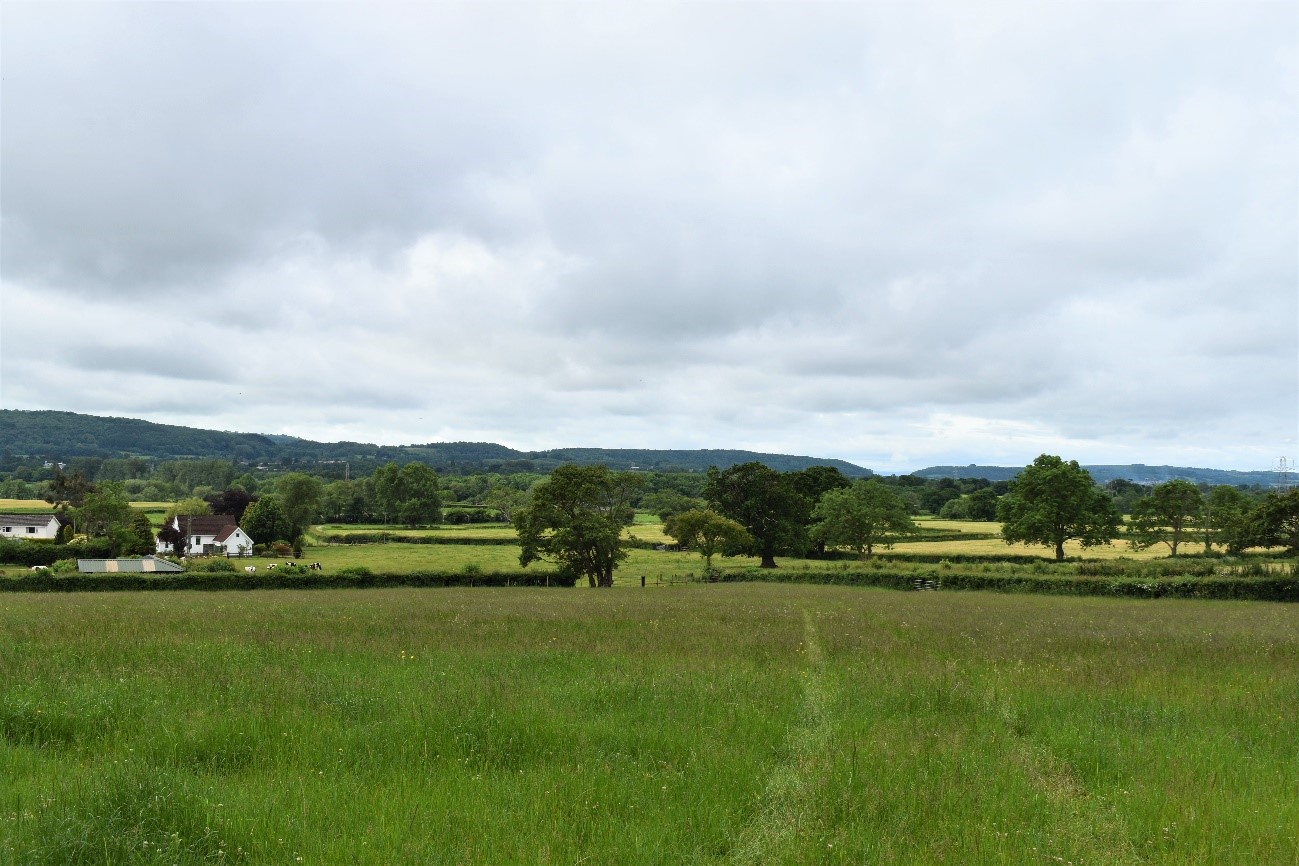
View across pastoral fields with mature in-field trees near Wrington (LCA J2) looking towards the Mendip Ridge (LCA E1).
The intricate field pattern and undulating topography in LCA J3 would sensitive to woodland expansion that could mask the small-scale field pattern.
The suburban character of LCA J4 could be enhanced by additional small and small-medium scale woodland planting which could enhance ecological connectivity and help to soften the urban edge.
Land cover composition of LCT J
There was an issue displaying the chart. Please edit the chart in the admin area for more details.View and export full results.
Landscape sensitivities
Landform (including scale and pattern)
- An undulating landscape of varying topography comprising the valley systems of several rivers, including the River Yeo, Lox Yeo, Land Yeo, Chew, Avon and Colliter’s Brook.
- The broad, shallow valleys of the Lox Yeo, Yeo, and Avon rivers (LCA J1, LCA J2, and LCA J6) would be less sensitive to new woodland planting than the complex steep slopes and isolated knolls in LCA J3.
Field and landcover pattern
- Landcover comprises a pattern of mixed size, predominantly pastoral fields bound by tall, thick hedges with hedgerow trees. Small, irregular fields (in LCA J3) would be more sensitive to larger-scale woodland planting that would mask the existing landscape structure, than the larger fields in LCA J4 and LCA J6.
- Existing semi-natural grassland habitats, many of which are locally or nationally designated, would be sensitive to woodland expansion as this could result in the loss of landscape and habitat diversity.
Historic landscape character
- Extensive historic field patterns of medieval and late-medieval enclosure would be sensitive to woodland expansion that could mask the historic landscape pattern.
- Designed landscapes associated with Leigh Court and Tyntesfield (designated as Registered Parks and Gardens) would be sensitive to medium to large-scale woodland that could detract from the historic integrity of the landscape.
- Historic assets of national significance (Scheduled Monuments) including Iron Age settlements, Roman artefacts, medieval features and a 17th century gunpowder works indicate higher sensitivity to woodland planting that could cause physical harm to heritage assets or impact their setting.
Visual character (including skylines)
- Frequent views to the wooded ridges of adjacent LCAs influence the character of the landscape, giving the impression of a more heavily wooded landscape. The Mendip Ridges and Combes (LCA E1) form a backdrop to LCA J1 and LCA J2, whilst Tickenham and Cleeve Ridges (LCA E5 and LCA E6) are prominent in views from LCA J4 and LCA J5.
- Views to Bristol, Pill and Long Ashton exert a strong urban influence across the north of the LCT and would be less sensitive to new woodland planting, which could help integrate the settlement edges into the landscape.
- Views to and from historic parklands and designed planting at Tyntesfield Estate, Ashton Court, and Leigh Court are sensitive to woodland expansion that could impact their setting and significance.
Perceptual and scenic qualities
- A strongly rural landscape with a pleasing combination of features including pastoral river valleys, estate parklands, intact hedgerows with mature trees, and traditional villages, stone-built farmsteads and churches.
- LCA J1 (and a very small area of LCA J2) are located within the Mendip Hills National Landscape. Special qualities include the scenic views to and from the National Landscape, calcareous grassland habitats, and the traditional pastoral landscape. The landscape of the National Landscape would be sensitive to large-scale woodland planting that could detract from these qualities.
- Suburban land uses, including ribbon development, golf courses and water treatment works, as well as major transport corridors (M5 motorway and trunk roads) have an urbanising effect, particularly in LCA J6 and LCA J4. These areas would be less sensitive to new woodland planting that could help to integrate these features into the landscape.
Assessment of landscape sensitivity to tree and woodland planting
Summary
Small and small-medium sized woodland is typical of this landscape and could generally be accommodated across the LCT. New woodland planting of this scale could reinforce the existing field patterns, and complement and extend the existing pattern of small to medium sized woodland blocks and copses, as well as enhancing the network of hedgerows and hedgerow trees. Much of LCA J1 is within the Mendip Hills National Landscape, which is nationally designated for its scenic qualities and is particularly sensitive to change.
New planting up to medium-sized woodland could provide opportunities to enhance woodland connectivity across the LCT and with adjacent landscapes in the surrounding Ridges and Combes landscapes. Existing small-medium sized woodlands in LCA J3 could be expanded and connected by planting new medium-sized woodland on the undulating slopes. Medium sized woodlands could also be used to screen settlement edges, urban land uses and solar PV developments (for example in LCA J2). As set out in the Forest of Avon Plan Tree and Woodland Strategy, new medium sized woodland planting in LCA J2 could contribute to enhancing connectivity across the “Aldwick Gapâ€, by creating a woodland corridor between the Mendip Ridges and Combes (LCA E1) and the extensive woodland complex in LCA E6.
There are currently no large sized mixed woodlands within this LCT, however the combined size of woodlands near Barrow Gurney (LCA J4) is over 30ha, and creates the impression of a large wooded area. There may be potential to further extend this area and other areas to buffer ancient woodland sites (for example along the course of the Markham Brook in LCA J6) and enhance connectivity across the landscape. The introduction of woodlands of this size would be less suitable in LCAs with small scale historic field patterns and where the existing woodland pattern comprises small sized copses, tree belts and hedgerow trees within the farmed landscape. Parkland-style planting associated with historic estates would also be sensitive to large scale new woodlands. LCAs within or overlooked by the Mendip Hills National Landscape would be more sensitive to new woodland planting of this size.
There are currently no commercial conifer plantations within this LCT. The introduction of this type and size of woodland would detract from the existing landscape character and is unlikely to be able to be accommodated in this LCT.
Any variations in landscape sensitivity
LCA J1: Lox Yeo Rolling Valley Farmland is located within the Mendip Hills National Landscape and would be more sensitive to new woodland planting due to its small-scale and traditional rural character, and strong intervisibility with the adjacent Mendip Ridges (LCA E1).
LCA J2: River Yeo Rolling Valley Farmland would be less sensitive to new woodland planting that could enhance connectivity between adjacent landscapes and help to integrate commercial orchards into the landscape. New woodland planting in this LCA could also be used to screen electricity infrastructure and solar PV developments.
LCA J3: Chew Rolling Valley Farmland would be more sensitive to medium and large-scale woodland planting that could mask the complex, undulating landform and enclose views towards the Mendip Hills National Landscape.
| Criteria | Small size native woodlands and trees outside woodlands (≤5ha) | Small-medium size native woodlands (>5 to 15ha) | Medium size native or mixed woodlands (>15 to 30ha) | Large size native or mixed woodlands (>30ha) | Medium-large size conifer plantation (>15ha) |
| Landform (including scale and pattern) | Low | Low | Low-Moderate | Moderate | Moderate |
| Field and landcover pattern | Low | Low-Moderate | Moderate | High | High |
| Historic landscape character | Low | Low-Moderate | Moderate | Moderate-High | Moderate-High |
| Visual character (including skylines) | Low | Low-Moderate | Moderate | Moderate | High |
| Perceptual and scenic qualities | Low | Low | Low-Moderate | Moderate | Moderate-High |
| Overall score | Low | Low-Moderate | Moderate | Moderate-High | Moderate-High |