Forest of Avon

6.1 LCT 1: Plateau and Scarp
The map below shows the location of LCAs within LCT 1: Plateau and Scarp. - View map full screen
For help on how to use this map click here.
Landscape Character Type description
The LCT comprises a visually-prominent scarp slope and elevated plateau extending along the eastern boundary of South Gloucestershire. The entire LCT is designated as part of the Cotswolds National Landscape. Within South Gloucestershire, LCT 1 comprises LCA 1: Badminton Plateau, LCA 2: Marshfield Plateau, LCA 3: Ashwicke Ridges, and LCA 4: Cotswold Scarp, as described in the South Gloucestershire LCA SPD (draft for adoption 2024), and shown on the mapping provided.
The western and southern parts of the LCT fall within South Gloucestershire Strategic Green Infrastructure (GI) Corridor: E (Cotswold Scarp and Ashwicke Ridges) related to the mosaic of woodland and grassland habitats associated with the Cotswold Scarp. Corridor E forms part of a wider strategic GI network that has been identified to protect designated landscape, heritage and ecological sites and features, well as connecting green and blue infrastructure for the benefit of both people and nature. Further detail is provided in the South Gloucestershire GI Corridor Mapping report (draft for adoption 2024).
Existing tree and woodland coverage
Woodland cover comprises 8.6% of the total landcover across the Plateau and Scarp LCT, being higher in LCA 1 and LCA 3, and lower in LCA 2. Ancient woodland accounts for 2.7% of landcover in this LCT, slightly higher than the average across South Gloucestershire (2%). There is a large area of ancient woodland large area at Swangrove Wood on the Badminton Plateau (LCA 1). Scattered small to medium-sized woodlands and copses punctuate the open plateau landscape, providing localised enclosure. On steeper slopes and along the escarpment, distinctive hanging beech woodlands mark the contours, whilst the upper scarp slopes are delineated by deciduous woodlands of mixed sizes. The landscape is influenced by historic estates, with wooded parkland, planted avenues, woodland belts, veteran trees and ornamental specimen trees set within open grassland. Occasional traditional orchards associated with farms on the scarp slope further contribute to the wooded character of the landscape.
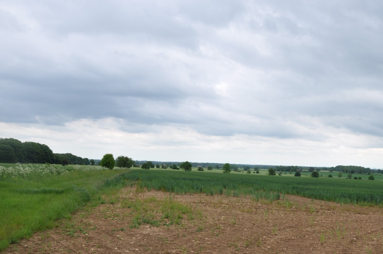
Open arable fields on the Badminton Plateau (LCA 1) with distinctive individual trees along field boundaries.
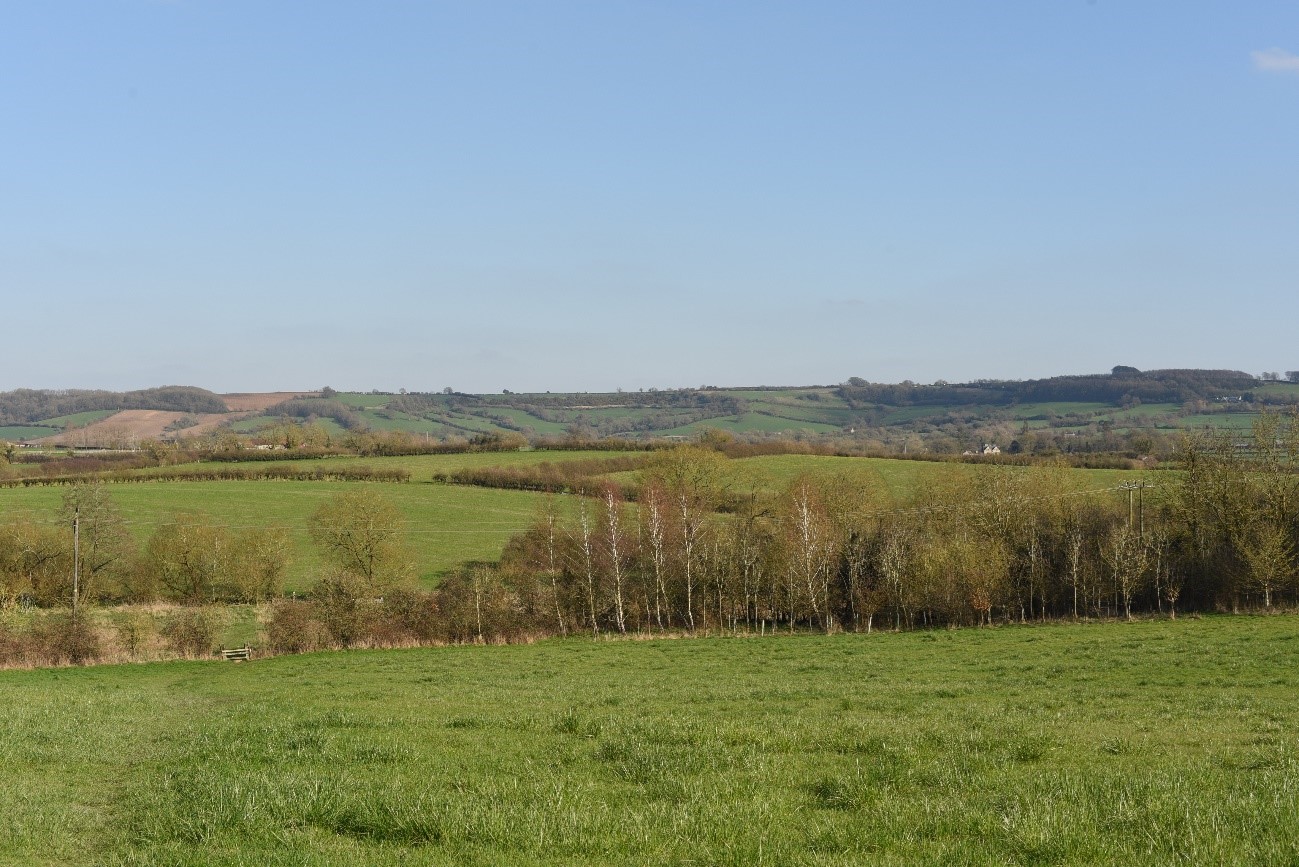
The woodland pattern is closely aligned with the landform along the Cotswold Scarp (LCA 4).
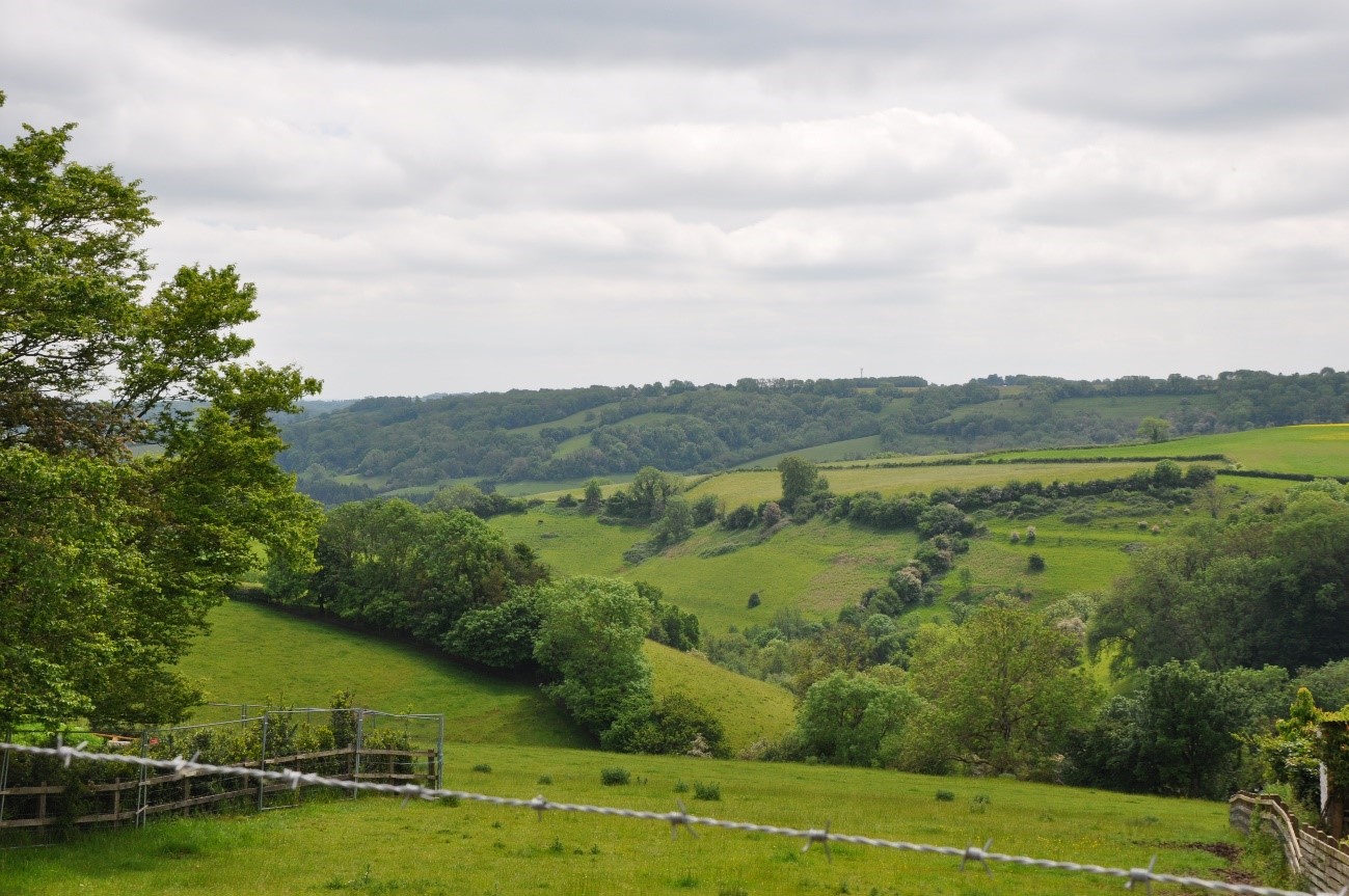
A wooded tributary stream valley of St Catherine’s Brook in LCA 3.
Landscape sensitivities
Landform (including scale and pattern)
- Sensitivity to new woodland planting varies within this LCT due to the variation in landform within the area.
- The existing pattern of woodland along the scarp (LCA 4) and within the valleys and ridges (LCA 3) reflects the shape and scale of the underlying landform, following the contours of the landscape. This pattern is sensitive to change from woodland expansion.
- The large-scale, gently undulating plateau (LCA 1 and northern extent of LCA 2) would be less sensitive to new woodland planting which could add texture and visual diversity to the landscape.
- The complex topography of rounded hills, ridges, and incised valleys in LCA 3 has shaped the vegetation pattern and is sensitive to new planting which could mask this. New woodland should closely align with the contours of the stream valleys, following the existing vegetation pattern.
- The Cotswold Escarpment (LCA 4) is identified as a Visually Important Hillside (VIH) and is sensitive to change as a prominent landform feature.
Field and landcover pattern
- Small-medium sized fields on the escarpment and valley slopes (LCA 3 and LCA 4) would be more sensitive to woodland planting that would mask the existing landscape pattern. Larger, more regular arable fields on the plateau (LCA 1, LCA 2) would be less sensitive to new woodland planting.
- Small-scale woodland planting (including the reinstatement of hedgerow trees) could enhance the existing hedgerow structure and improve habitat connectivity.
- Drystone walls on the plateau (LCA 1 and LCA 2) are noted as a special quality of the CNL and would be sensitive to new woodland planting that could mask these distinctive landscape features.
- Existing semi-natural calcareous and neutral grassland habitats (including St Catherines Valley SSSI and numerous Local Wildlife Sites) would be sensitive to woodland expansion that could result in the loss of landscape and habitat diversity.
- Ancient woodlands on the scarp and plateau and in the south of the LCT would be vulnerable to insensitive and inappropriately sited woodland expansion.
Historic landscape character
- The extensive historic field patterns (including medieval enclosures and in LCA 3), would be sensitive to medium and large-scale planting which would dilute the historic landscape character.
- Nationally-significant historic assets (designated as Scheduled Monuments) including Prehistoric tumuli, barrows, prominent Iron Age hill forts, a Roman Villa, and a Registered Battlefield, indicate higher sensitivity to woodland planting that could have the potential for physical harm to heritage assets or impact on their setting.
- Historic settlements with conservation areas including Marshfield, Cold Ashton and Upton Cheyney would be sensitive to woodland expansion that could alter their setting or significance.
- Historic parkland estates, including Badminton Estate, Dodington House, Dyrham Park, and Ashwicke Hall (all RPGs), would be sensitive to new medium and large-scale woodland planting that could enclose designed views from the estates or detract from the historic integrity of the landscape.
Visual character (including skylines)
- The open and expansive views experienced from the plateau (LCA 1 and LCA 2) and scarp slope (LCA 4) would be particularly sensitive to larger-scale woodland planting that could screen or enclose these views.
- Scenic views from popular visitor destinations, including the Cotswold Way National Trail, promoted viewpoints along the escarpment, and designed views from Dyrham Park, would be sensitive to woodland expansion that could enclose views from these key viewpoints.
- Distinctive skyline features including the church towers at Cold Ashton and Marshfield (LCA 2), the prominent line of beech trees on Freezing Hill, and the Somerset Monument form local landmarks on the skyline within the LCT. New woodland should be carefully designed and sited to avoid screening views of these features.
- The Cotswold Scarp (LCA A4) and Ashwicke Ridges (LCA A3) are noted as Visually Important Hillsides (VIH) and contain several Strategic Viewpoints (SVP) that afford views into and from the LCT, including to and from the Cotswolds National Landscape. These viewpoints are sensitive to new planting which could with these key visual relationships.
- Parts of LCA 3 form part of the wider setting of the City of Bath World Heritage Site (WHS), with several hills identified in viewpoints from within the WHS. These areas are particularly sensitive to new planting which could interfere with these key visual relationships.
- Key views towards and from Conservation Areas, including the panoramic views south from Cold Ashton and Marshfield, would be sensitive to woodland expansion that could impact their setting and significance.
Perceptual and scenic qualities
- A strongly rural and tranquil landscape with pleasing combination of features including steep wooded ridges and rolling plateaux, traditional pastoral landscape, drystone walls and intact hedgerows, estate parkland, scattered hamlets, and traditional stone-built villages.
- The LCT lies wholly within the Cotswolds National Landscape. Special qualities that would be particularly sensitive to woodland expansion include the open arable landscapes with big skies, and the flower-rich limestone grasslands.
- The LCT would be sensitive to large-scale woodland planting that could alter the scenic qualities of the National Landscape. However, smaller-scale new woodland may present opportunities to enhance habitat connectivity and landscape structure.
- The rural character and sense of tranquillity of the LCT are disrupted by the presence of traffic on the M4 motorway and ‘A’ roads, and a golf course (LCA 4). New woodland planting could help to integrate these features into the landscape.
Assessment of landscape sensitivity to tree and woodland planting
Summary
Small and small-medium sized woodland is typical of this landscape and could generally be accommodated across the LCT. This scale of woodland planting could increase habitat connectivity and reinforce the existing patterns of tree cover along watercourses and field boundaries without adversely impacting the landscape character. New small-medium size woodland could contribute to enhancing connectivity across the landscape, as well as with adjacent lowland landscapes, without compromising the open character of the CNL. New medium-planting should be sited and designed to avoid masking key views from SVPs, VIH, and viewpoints to and from the City of Bath WHS.
Medium-sized woodlands are typical of this landscape, and new planting could provide opportunities to enhance woodland connectivity across the LCT and with adjacent landscapes in the surrounding ridges and valleys. New medium-sized native woodland planting could link existing woodlands on the Badminton Estate (LCA 1) to those at the Dodington Estate (within LCA 4) and consolidate a woodland corridor between Dyrham Park and Dodington (LCA 4), as set out in the Forest of Avon Plan Tree and Woodland Strategy. However, woodland of this size could mask the remnant medieval field patterns and should not be sited in areas where these exist. Areas of species-rich grassland, including calcareous grassland and lowland meadows, would be sensitive to new woodland of this size if not appropriately located. New medium-scale woodland planting should be sited and designed to avoid masking key views from SVPs, VIH, and viewpoints to and from the City of Bath WHS.
The LCT contains some existing large-size woodland. Sensitivity to woodland planting of this scale varies between the LCAs; the intricate and complex landform of LCA 3 and LCA 4, and the southern extent of LCA 2 would be highly sensitive to large-scale woodland planting, whereas larger-scale fields on the plateau (LCA 1 and LCA 2) would be less sensitive to woodland planting of this size (avoiding semi-natural grassland habitats). Parkland-style planting associated with historic estates would be sensitive to large-scale new woodland that could dilute the setting and integrity of historic landscapes, including designed views from the estates. New large-scale woodland planting should be sited and designed to avoid masking key views from SVPs, VIH, and viewpoints to and from the City of Bath WHS.
There are currently no commercial conifer plantations within this LCT. The introduction of this type and size of woodland would be incongruous with the existing landscape pattern and would detract from the distinctive characteristics of the landscape, including remnant medieval field patterns, the mosaic of semi-natural grassland and woodland habitats (including ancient woodland), historic designed parklands, and the scenic qualities of the landscape identified through its designation as part of the Cotswolds National Landscape.
Any variations in landscape sensitivity
LCA 3: Ashwicke Ridges and LCA 4: Cotswold Scarp are more sensitive to new woodland planting due to their complex landforms and visual prominence. Several hills within LCA 3 are visible from key viewpoints within the City of Bath World Heritage Site and are noted to be important in forming part of the setting to the WHS. New woodland planting should be designed and sited to avoid masking these key visual relationships. There may be opportunities to link existing areas of ancient woodland with new woodland of similar species composition to enhance ecological connectivity between the ridges and scarp slope.
Table A.1: Assessment of landscape sensitivity to tree and woodland planting: assessment scores
| Criteria | Small size native woodlands and trees outside woodlands (≤5ha) | Small-medium size native woodlands (>5 to 15ha) | Medium size native or mixed woodlands (>15 to 30ha) | Large size native or mixed woodlands (>30ha) | Medium-large size conifer plantation (>15ha) |
| Landform (including scale and pattern) | Low | Low-Moderate | Moderate | High | High |
| Field and landcover pattern | Low | Low-Moderate | Moderate | Low-Moderate | High |
| Historic landscape character | Low | Low-Moderate | Low-Moderate | High | High |
| Visual character (including skylines) | Low | Low | Moderate | High | High |
| Perceptual and scenic qualities | Low | Low-Moderate | Moderate | High | High |
| Overall score | Low | Low-Moderate | Moderate | High | High |
Tree and Woodland planting guidance
- Ensure new woodland planting is closely aligned with the existing vegetation pattern, following the contours of the landscape including along the Cotswold scarp (LCA 4) and within the complex hills, ridges, and incised valleys in the south of the LCT (LCA 3).Ensure new planting on the escarpment retains the organic form, relationship to the landform, and interlocking patterns with hedgerows.
- Avoid siting woodland across multiple fields which would mask historic field patterns, where these are identified as medieval in origin, and protect the remnant areas of ridge and furrow.
- Create woodland corridors to enhance the mosaic of woodland and grassland habitats and increase connectivity between different habitat types, including the existing areas of lowland meadows, calcareous grassland and deciduous woodland.
- Enhance riparian habitats by planting along and within river corridors and tributary valleys (e.g. the Broadmead Brook Valley) using native species such as willow.
- Prioritise new planting where woodland has been lost and encourage natural regeneration, particularly in proximity to ancient woodlands. Extend and link existing woodlands rather than creating new stand-alone woods, in line with guidance set out in the Cotswolds AONB Landscape Strategy for Area 2: Escarpment and Area 7: High Wold.
- Avoid adversely affecting designated historic landscapes directly or indirectly, including the historic parkland at Badminton Estate, Dodington House, Dyrham Park, and Ashwicke Hall.
- Enhance and extend wood pasture and parkland habitat associated with the historic parkland estates. Seek opportunities to create links with nearby woodland habitats to enhance habitat connectivity across the landscape and contribute to nature recovery networks.
- Preserve and enhance the landscape setting of conservation areas, together with key views to and from key features, including listed buildings. Ensure new woodland planting does not detract from their landscape setting or enclose key views to and from the settlements.
- Retain the open character and wide panoramic views experienced across the plateau and valleys which are an important characteristic of this landscape. Ensure new woodland planting does not enclose views from the escarpment (LCA 4) and plateau (LCA 1 and LCA 2).
- New woodland planting should be sensitively designed and sited to avoid screening views towards distinctive skyline features including the church towers at Cold Ashton and Marshfield, the prominent line of Beech trees on Freezing Hill, and the Somerset Monument.
- Ensure new woodland planting does not enclose or screen views from popular visitor destinations, including the Cotswold Way National Trail, promoted viewpoints along the escarpment, and designed views from Dyrham Park.
- New woodland planting within the Cotswolds National Landscape or its setting should be designed to complement and conserve the special qualities of the landscape, reflecting guidance set out in the Cotswolds AONB Landscape Strategy.
- Refer to LCA-specific guidance set out in the Forest of Avon Plan Tree and Woodland Strategy.
- Any new planting should follow principles of good design, as set out in the UK Forestry Standard.