Forest of Avon

6.8 LCT 8: Levels
The map below shows the location of LCAs within LCT 8: Levels. - View map full screen
For help on how to use this map click here.
Landscape Character Type description
A flat, low-lying area of intertidal shoreline and farmland located in the north-west of the district. The influence of the estuary, distinctive pattern of drainage ditches, and open, exposed character define this landscape. Within South Gloucestershire, LCT 8 comprises LCA 19: Oldbury Levels, LCA 20: Pilning Levels, LCA 21: Severn Shoreline & Estuary, as described in the South Gloucestershire LCA SPD (draft for adoption 2024), and shown on the mapping provided.
Note: LCA 21: Severn Shoreline and Estuary is excluded from this assessment as it comprises open water and intertidal mudflats, and therefore is unsuitable for woodland planting.
South Gloucestershire Strategic Blue-Green Infrastructure Corridor A: Shepperdine-Oldbury on Severn-Severn Beach (Severn Estuary and Levels) covers a large proportion of this LCT, predominantly related to the wetland strategic network associated with the river corridor, estuary, and network of rhines and watercourses across the Levels. Corridor A forms part of a wider strategic GI network that has been identified to protect designated landscape, heritage and ecological sites and features, well as connecting green and blue infrastructure for the benefit of both people and nature. Further detail is provided in the South Gloucestershire GI Corridor Mapping report (draft for adoption 2024).
Existing tree and woodland coverage
Woodland cover across the Estuary, Shoreline and Levels LCT makes up 1.4% of total land cover across the LCT, the lowest in the district. Woodland typically occurs as small farm woodlands and as linear belts of deciduous woodland. Trees outside woodland, including frequent hedgerow trees, pollards, remnant withy beds (willow coppice), and traditional orchards, are locally distinctive features and make up a substantial proportion of the overall canopy cover in this LCT.
Mature hedgerow trees make an important contribution to canopy cover across the LCT.
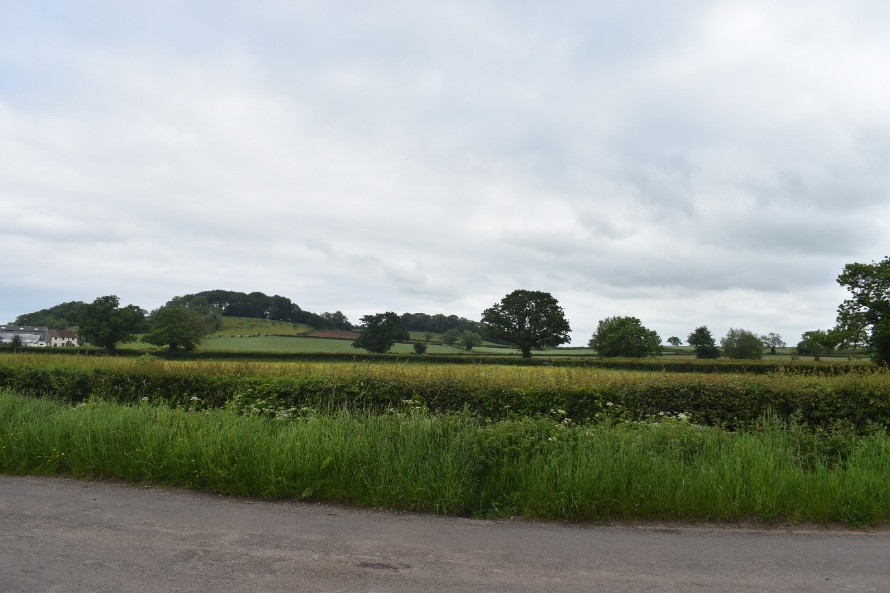
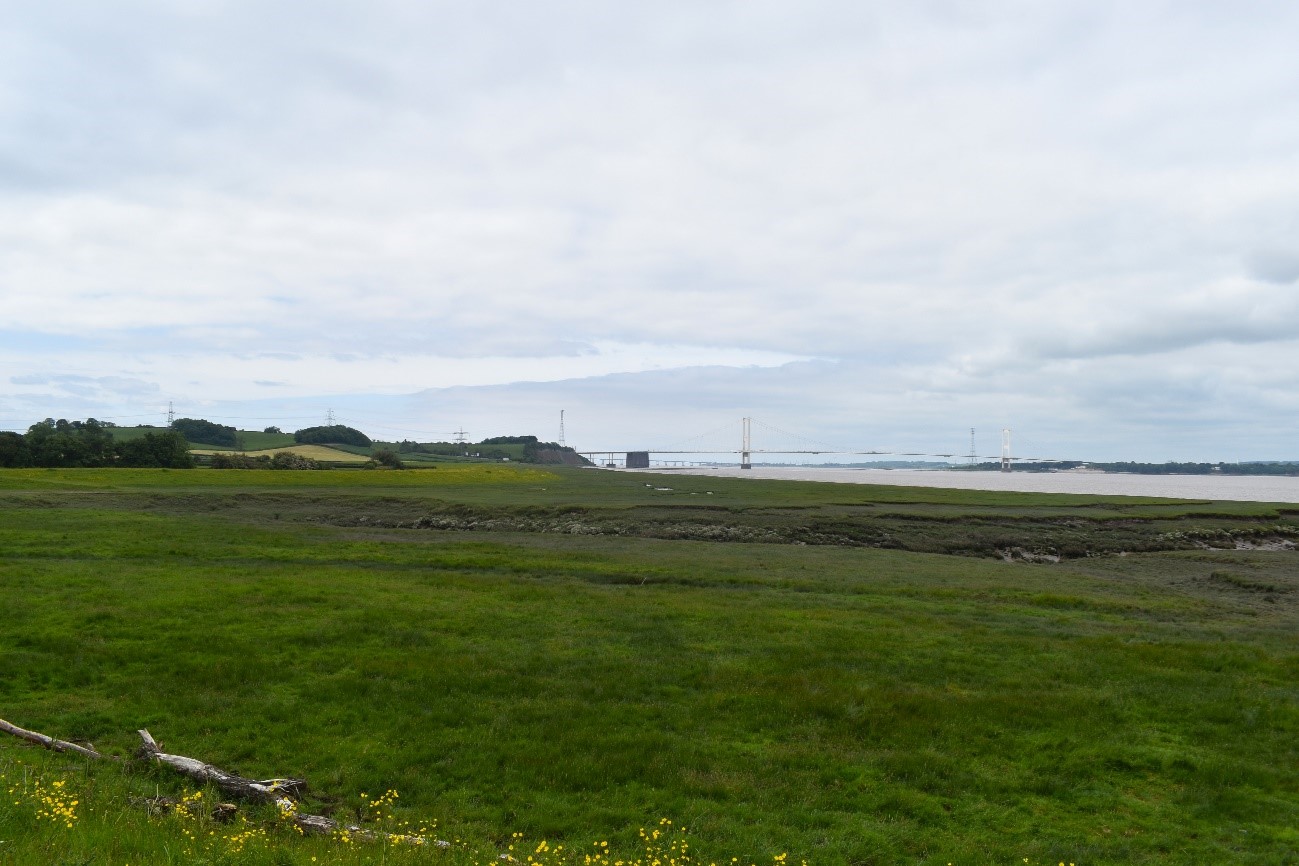
The open character and relatively sparse woodland cover enables long views towards the Severn Estuary.
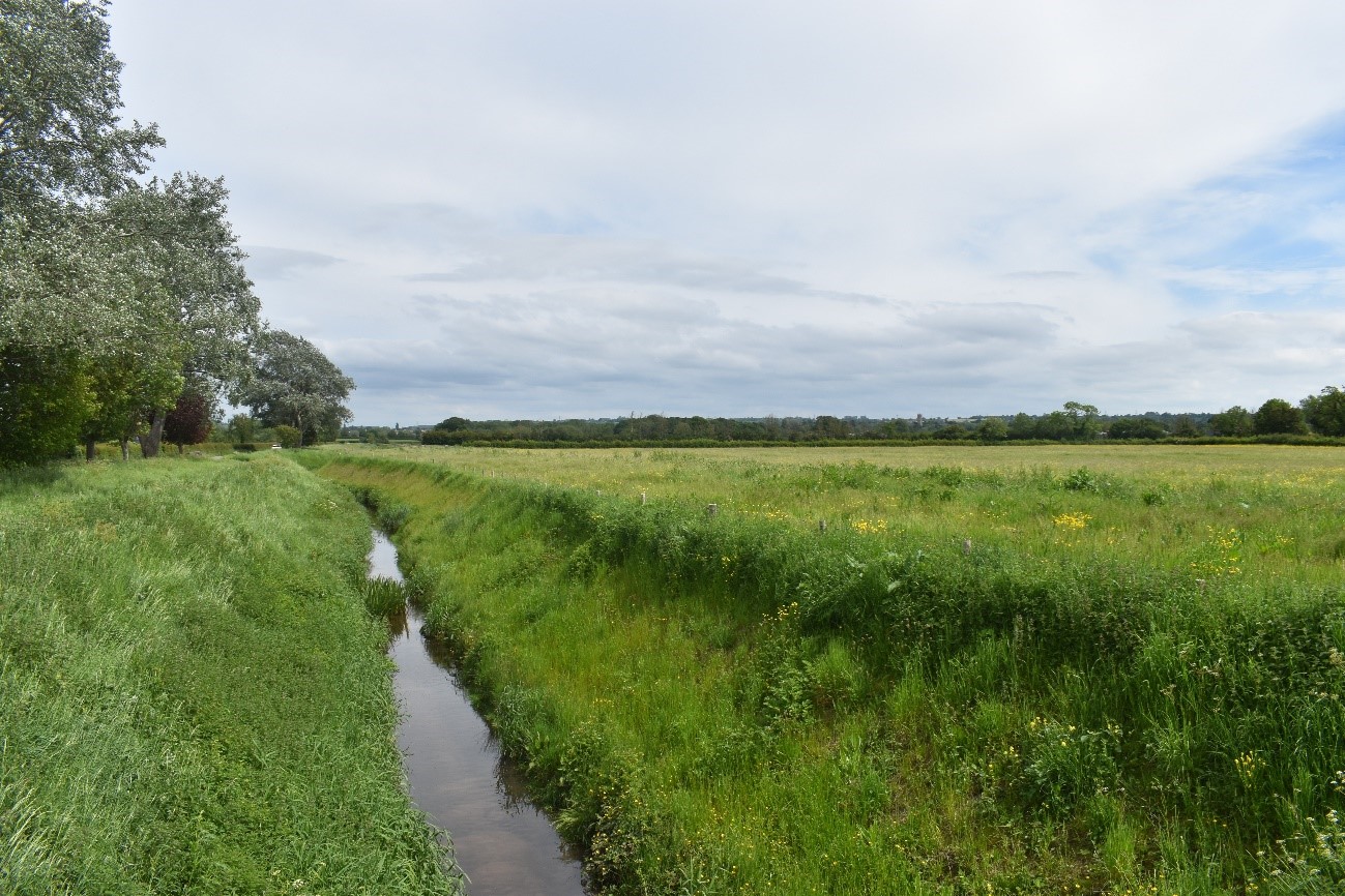
Open pastoral fields with ditches lined by willow trees are a distinctive feature of the LCT.
Landscape sensitivities
Landform (including scale and pattern)
- The simple landform of the flat, low-lying Levels (lying at less than 10m AOD) and large scale of the landscape indicates lower sensitivity to woodland expansion. New woodland planting could also accentuate any subtle undulations in the landform, such as the isolated knolls.
Field and landcover pattern
- The distinctive field pattern of irregular, small-scale pasture fields defined by hedgerows, mature trees, and an angular network of rhines/ditches would be sensitive to new woodland planting of medium size and larger, which could mask the distinctive landscape structure.
- Expansive areas of coastal and floodplain grazing marsh and other wetland habitats (including locally designated sites) would be sensitive to woodland expansion as this could result in the loss of landscape and habitat diversity. However, small-medium scale woodland planting could enhance habitat connectivity.
Historic landscape character
- The presence of remnant medieval field patterns and areas of visible ridge and furrow (particularly in the north) indicate a long history of settlement in the landscape and would be sensitive to new woodland planting that could mask these features if not appropriately designed and sited.
- The presence of heritage features of national importance including Oldbury Camp Iron Age hillfort and the moated Olveston Court (Scheduled Monuments) indicates higher sensitivity due to the potential for physical harm and impacts on their setting resulting from new woodland planting.
Visual character (including skylines)
- The distinctively flat and open landscape enables expansive views west towards the estuary and across to Wales, and towards the wooded hillside of the Severn Ridge to the east. The landscape is sensitive to planting that could interfere with these key visual relationships.
- Prominent landmarks including the two Severn Bridges, and the church at Oldbury-on-Severn, located on a prominent elevated knoll, form distinctive landmark features in many views and would be sensitive to woodland expansion that could screen views to these features.
- Areas of industrial development including chemical works, Oldbury Power Station, warehouses and overhead powerlines in the south of the LCT are visually intrusive and would be less sensitive to new woodland planting which could filter views and help to integrate these features into the landscape.
Perceptual and scenic qualities
- A rural, peaceful landscape with a combination of pleasing features including stone-built farmsteads, traditional orchards, and pastoral fields bound by a network of hedgerows, mature trees, and ditches.
- Busy transport routes (including the M4/M5 and a railway) and industrial development in the south (LCA 20) dilute the sense of tranquillity and perceptions of remoteness. New woodland planting could help to screen development in these areas.
Assessment of landscape sensitivity to tree and woodland planting
Summary
Small and small-medium sized woodland creation could be accommodated across the LCT. New woodland planting of this size could reinforce the existing field pattern, and complement and extend the existing pattern of scattered small woodland copses and remnant withy beds. New small woodlands could also enhance and complement the pattern of trees outside woodland in the farmed landscape, including through increasing connectivity with the network of trees within hedgerows, and new planting of trees in field corners and on marginal land. Historically this landscape has supported orchards, which could be reinstated and expanded to reinforce the traditional character and enhance habitat diversity, as set out in the Forest of Avon Plan Tree and Woodland Strategy.
There are currently no medium-sized woodlands in this LCT. The existing landscape pattern of small-scale fields , the distinctive rhines and hedgerows, and the remnant visible ridge and furrow would be more sensitive to new woodland planting of this size. However, new medium sized woodland planting, including reinstatement and extension of withy beds (willow coppices) could provide opportunities to enhance woodland connectivity across the LCT and with adjacent landscapes, including with the wooded slopes of the adjacent LCA 18: Severn Ridge. Medium sized woodland could also be used to screen industrial development and transport corridors in the south of the LCT.
There is an existing large sized woodland within this LCT at Mill Rhine Plantation, however there is limited opportunity for further new planting of this size, which would be discordant with the existing woodland pattern and has the potential to mask characteristic landscape features including the small-medium scale field pattern, distinctive pattern of rhines and ditches, and existing pattern of small copses, remnant withy beds and traditional orchards. Large-scale new woodland could enclose the open views across the Levels towards the Severn Estuary, and screen views to distinctive landmark features.
There are currently no commercial conifer plantations within this LCT. The introduction of this type and size of woodland would be incongruous with the existing landscape pattern and would detract from the distinctive characteristics of the landscape.
Any variations in landscape sensitivity
LCA 20: Pilning Levels would be less sensitive to new woodland planting which could help to integrate industrial development into the landscape.
| Criteria | Small size native woodlands and trees outside woodlands (≤5ha) | Small-medium size native woodlands (>5 to 15ha) | Medium size native or mixed woodlands (>15 to 30ha) | Large size native or mixed woodlands (>30ha) | Medium-large size conifer plantation (>15ha) |
| Landform (including scale and pattern) | Low | Low | Low-Moderate | Low-Moderate | Moderate-High |
| Field and landcover pattern | Low | Moderate | Moderate-High | High | High |
| Historic landscape character | Low | Low-Moderate | Moderate | High | High |
| Visual character (including skylines) | Low | Moderate | Moderate-High | High | High |
| Perceptual and scenic qualities | Low | Low-Moderate | Moderate | High | High |
| Overall score | Low | Moderate | Moderate-High | High | High |
Tree and Woodland planting guidance
- Manage the historic field pattern, including through willow pollarding and management of withy beds and tree belts, to ensure long term conservation of these key features for their cultural and biodiversity value.
- Avoid siting woodland across multiple fields which would mask the historic, small-scale field pattern.
- Actively manage features which contribute to the historic field and land cover pattern, including willow pollarding, withy bed management, and orchard restoration, to help ensure the conservation and biodiversity value of these characteristic features.
- Ensure new woodland does not mask the extensive drainage network of rhines, and remnant ridge and furrow, to retain the historic landscape character of the levels.
- Maintain and enhance existing hedgerows and increase associated tree cover including tree belts, which are a distinctive feature of the LCT.
- Promote new small-medium-scale farm woodlands (including withy beds and traditional orchards), where this supports farm diversification and fits with the existing farm woodland landscape.
- Conserve willow pollards, re-pollarding these as necessary to ensure long-term contribution to landscape character and as a farm timber resource. Establish small, irregular groups of native large willow adjacent to watercourses where permitted by statutory conservation designations.
- Seek opportunities for new tree and woodland planting to enhance or buffer with the international and national nature conservation designations on the Severn Estuary, including high tide roosts.
- Restore, enhance and create new traditional orchards to enhance landscape character and biodiversity value.
- Ensure new woodland creation is not at the expense of wetland habitat conservation and enhancement. Seek opportunities to create wildlife corridors between woodland and wetland habitats to enhance ecological connectivity.
- Ensure new woodland planting does not enclose or screen key views, including long views west towards the Severn Estuary and east towards the Severn Ridge (LCT 7).
- New small-medium scale woodland planting e.g. withy beds, pollards, or traditional orchards could help to integrate new development into the landscape, including industrial development at Avonmouth Severnside Enterprise Area (ASEA), as well as major road corridors and extensive industrial development in the south of the LCT.
- Refer to LCA-specific guidance as set out in the Forest of Avon Plan.
- Any new planting should follow principles of good design, as set out in the UK Forestry Standard.