Forest of Avon

6.7 LCT 7: Undulating Ridge
The map below shows the location of LCAs within LCT 7: Undulating Ridge. - View map full screen
For help on how to use this map click here.
Landscape Character Type description
An extensive, prominent and distinctive ‘ridge’ landform running north-east to south-west across the western part of South Gloucestershire. The ridge rises up from the lowland levels to the west and less distinctly from the simple rolling vales to the east. Within South Gloucestershire, LCT 7 comprises LCA 17: Rudgeway Ridge & Tytherington Ridge, and LCA 18: Severn Ridges, as described in the South Gloucestershire LCA SPD (draft for adoption 2024), and shown on the mapping provided.
South Gloucestershire Strategic Green Infrastructure Corridor B: Charfield, Alveston-Hallen (Western Scarp/Severn Ridges) covers a large proportion of this LCT, predominantly associated with the woodland strategic network on the ridges. Corridor B forms part of a wider strategic GI network that has been identified to protect designated landscape, heritage and ecological sites and features, well as connecting green and blue infrastructure for the benefit of both people and nature. Further detail is provided in the South Gloucestershire GI Corridor Mapping report (draft for adoption 2024).
Existing tree and woodland coverage
Woodland cover comprises 8% of the total landcover across the Undulating Ridge LCT which is relatively high in the context of South Gloucestershire. Ancient woodland accounting for 3% of total landcover, concentrated along the Severn Ridge (LCA 18). Woodland typically occurs in blocks of broadleaved native woodland of varying size, with areas of medium and large size mature broadleaved woodland along the scarp slope of the Severn Ridge, and a regular pattern of native woodland copses and small farm woodlands dispersed throughout the farmed landscape (some identified as SNCI). Occasional hedgerow trees, linear woodland along the A38, and ornamental species within historic parks further contribute to the wooded character of the landscape. Some traditional orchards remain around settlements and farms, and there is a large commercial orchard to the north of Almondsbury.
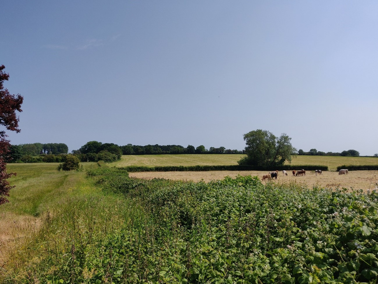
Pasture fields enclosed by hedgerows with occasional hedgerow trees, near Rudgeway (LCA 17).
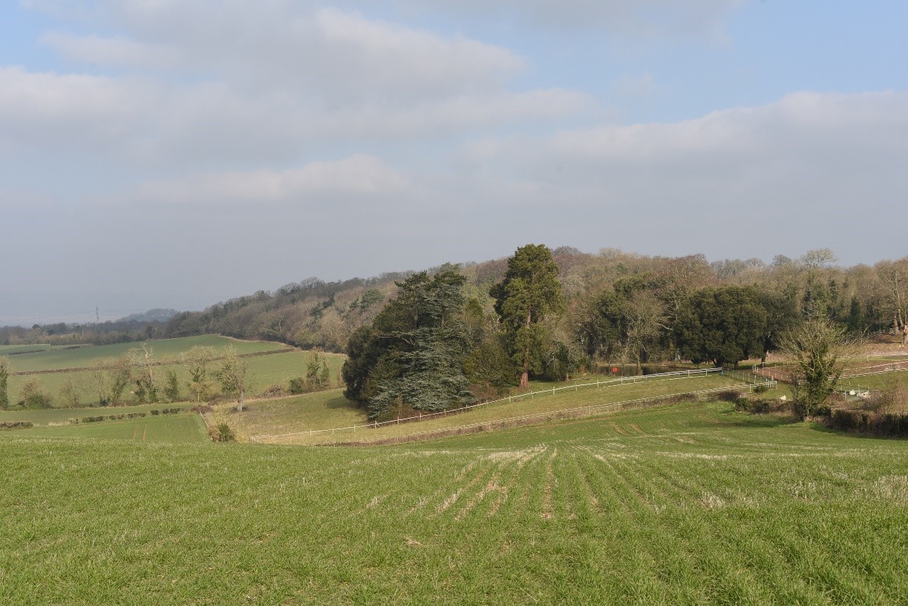
Wooded hillside and parkland style trees near Old Down (LCA 18).
Landscape sensitivities
Landform (including scale and pattern)
- The scarps and ridges within the LCT provide a distinctive backdrop to surrounding lowland landscapes, particularly to the adjacent Levels in LCA 20.
- The scarp slope of the Severn Ridge and its outliers, and the east-facing hills (Wick’s Hill/Butcher Hill and Baden Hill) are identified as Visually Important Hillsides and are sensitive to change due to their prominent landform.
- The existing woodland pattern along the ridges and hills reflects the shape and scale of the underlying landform, following the contours of the hillside. This pattern is sensitive to change from woodland expansion.
- The south-western extents of the Severn Ridge including Berwick Wood, Hakes Hill Wood and Blackhorse Wood are more wooded and would be less sensitive to change from small-medium scale woodland planting.
Field and landcover pattern
- The pattern of smaller-scale pastoral fields on the steeper slopes enclosed by hedgerows are sensitive to woodland expansion which could mask the existing landscape structure. Larger scale, more intensively farmed, arable fields on gentler slopes would be less sensitive to change from woodland planting.
- Existing woodland and grassland habitats of national significance including Sites of Special Scientific Interest (SSSI) are particularly sensitive to woodland expansion as this could result in the loss of landscape and habitat diversity.
- Ancient woodlands (including at Haw Wood, Blackhorse Wood and Spaniorum Hill) would be vulnerable to woodland expansion if quantity and species of tree was not considered. However, carefully sited new woodland could enhance connectivity or act as a buffer to protect against changing weather patterns.
Historic landscape character
- The presence of Prehistoric enclosures and hill forts of national importance (several are designated as Scheduled Monuments) indicate higher sensitivity, as new woodland would need to take into account the potential for physical harm to heritage assets and impacts on their setting.
- Historic estates at Old Down and Thornbury Park (with designed landscapes and specimen trees) would be sensitive to medium and large-scale woodland planting that could mask or detract from the historic integrity of the landscape.
- Conservation Areas at Thornbury, Almondsbury, Olveston, Tockington and Tytherington would be sensitive to new woodland planting that could alter their setting or significance.
- Some remnant ridge and furrow, laid hedges and old orchards remain visible and evoke a sense of time depth in the landscape. New woodland planting could mask these features if not appropriately designed and sited.
Visual character (including skylines)
- Extensive scenic views are afforded from many open parts of the Severn ridge, including westwards across the low-lying Levels towards the Severn Estuary and beyond to the hills in South Wales, and east towards the Cotswold Scarp. This includes seven Strategic Viewpoints located along the Severn Ridge in LCA 18. The landscape is sensitive to planting that could interfere with these key visual relationships.
- Settlements are typically located at high points on the ridgeline, with church towers forming local landmarks. These features are sensitive to planting that could impact their setting.
- New residential development on the edge of Thornbury (LCA 18) as well as quarry infrastructure and solar PV developments (LCA 17) are visually detractive. New woodland planting could help to integrate these features into the landscape.
Perceptual and scenic qualities
- A scenic rural landscape with a pleasing combination of features, including dramatic landforms, visual contrasts, historic settlements and stone-built farmsteads. Existing woodlands make an important contribution to the rural character of the area and help to screen motorway corridors and modern ribbon development along the A38.
Assessment of landscape sensitivity to tree and woodland planting
Summary
Small and small-medium sized woodland creation could be accommodated across the LCT. New woodland planting of this scale could reinforce the existing field patterns, and complement and extend the existing pattern of small to medium sized woodland blocks and copses, as well as trees within hedgerows. Historically this landscape has supported orchards, which could be reinstated to reinforce the traditional character, and enhance landscape diversity. As set out in the Forest of Avon Plan Tree and Woodland Strategy, new small-medium sized native woodland could be established in the ‘A38 Gap’ to enhance the woodland framework around the edge of Thornbury. This could include small-scale native woodland planting along upper slopes and ridge tops linking to woodland in lower lying land at the foot of the ridges and enhancing the parkland to the east of Thornbury to enhance habitat connectivity and reinforce the landscape structure.
New planting up to medium-sized woodland could provide opportunities to enhance woodland connectivity across the LCT and with adjacent landscapes in the surrounding ‘levels’ and ‘vales’ landscapes. Medium sized woodland could also be used to screen new housing developments on the edge of Thornbury, as well as workings at Tytherington Quarry, and Solar PV developments (in LCA 17: Rudgeway and Tytherington Ridge). The remnant areas of historic small-scale field patterns and ridge and furrow would be more sensitive to new woodland planting of this size.
There are currently no large sized mixed woodlands within this LCT. The introduction of woodlands of this size would be discordant with the existing woodland pattern and has the potential to mask characteristic landscape features, including the small-medium scale field patterns and existing pattern of small and medium sized copses and hedgerow trees within the farmed landscape, as well as remnant ridge and furrow, and the parkland-style trees associated with historic estates. New large-scale woodland would enclose the open views available from the scarp slope.
There are currently no commercial conifer plantations within this LCT. The introduction of this type and size of woodland would detract from the existing landscape character.
Any variations in landscape sensitivity
LCA 18: Severn Ridge is more sensitive to medium and large-scale woodland planting (including coniferous plantations) due to the remnant parkland associated with historic estates, and the extensive views available from the open upper slopes (indicated by the presence of several Strategic Viewpoints identified along the ridgeline) which would be enclosed by extensive new planting.
| Criteria | Small size native woodlands and trees outside woodlands (≤5ha) | Small-medium size native woodlands (>5 to 15ha) | Medium size native or mixed woodlands (>15 to 30ha) | Large size native or mixed woodlands (>30ha) | Medium-large size conifer plantation (>15ha) |
| Landform (including scale and pattern) | Low | Moderate | Moderate-High | Moderate-High | High |
| Field and landcover pattern | Low |
Low-Moderate |
Moderate | High | High |
| Historic landscape character | Low-Moderate | Low-Moderate | Moderate | Moderate-High | High |
| Visual character (including skylines) | Low | Low-Moderate | Moderate | High | High |
| Perceptual and scenic qualities | Low-Moderate | Low-Moderate | Moderate | Moderate-High | Moderate-High |
| Overall score | Low | Low-Moderate | Moderate | High | High |
Tree and Woodland planting guidance
- Design woodland to align along existing contours and undulations of the ridges, ensuring the distinctive scarp slope of the Severn Ridge, east facing hills, and small wooded outlier hills (including Titters Hill, Henley Hill and Fowler’s Hill) are not enclosed by new planting.
- Avoid siting new woodland across multiple fields which would mask the small-scale field pattern.
- Actively manage existing hedgerows, hedgerow trees, and woodland to maintain the wooded character and biodiversity value of the ridges.
- Manage existing woodland and hedgerows to frame and maintain characteristic views (including from Strategic Viewpoints) across the adjacent Levels landscape and the Severn Estuary (LCT 8).
- Protect and buffer ancient woodlands at Haw Wood, Blackhorse Wood and Spaniorum Hill by establishing fringing areas and encourage natural regeneration.
- Ensure new woodland planting does not adversely affect important semi-natural grassland habitats in order to maintain their biodiversity value and contribution to nature recovery networks, and in contributing towards the maintenance of characteristic panoramic views.
- Protect and restore remaining areas of traditional orchard and seek opportunities to create new ones to strengthen landscape character and enhance biodiversity value.
- Seek opportunities to create new woodland habitat and enhance ecological corridors between existing habitats as part of the restoration of Tytherington Quarry.
- Increase tree cover on eastern facing slopes and along the principal road corridors to reinforce landscape structure and mitigate impact on views from higher ground to the east.
- Maintain the mature trees and woodland within Old Down and Thornbury Park, and encourage new tree planting where they have been lost, to reinstate the parkland character of the historic parks.
- Conserve and enhance the landscape setting of Conservation Areas at Thornbury, Almondsbury, Olveston, Tockington and Tytherington, together with key views towards and from them.
- Ensure new woodland planting does not obscure views to local landmarks, including Grade I listed churches and Thornbury Castle.
- Encourage succession planting to ensure long term protection of the wooded character of the ridgeline as a rural backcloth to views from surrounding lowland landscapes. Ensure new woodland planting does not diminish the role and significance of the Severn Ridge as a Visually Important Hillside, as identified in the South Gloucestershire LCA (draft for adoption 2024).
- Refer to LCA-specific guidance as set out in the Forest of Avon Plan.
- Any new planting should follow principles of good design, as set out in the UK Forestry Standard.