Forest of Avon

6.4 LCT 4: Shallow Vale
The map below shows the location of LCAs within LCT 4: Shallow Vale. - View map full screen
For help on how to use this map click here.
Landscape Character Type description
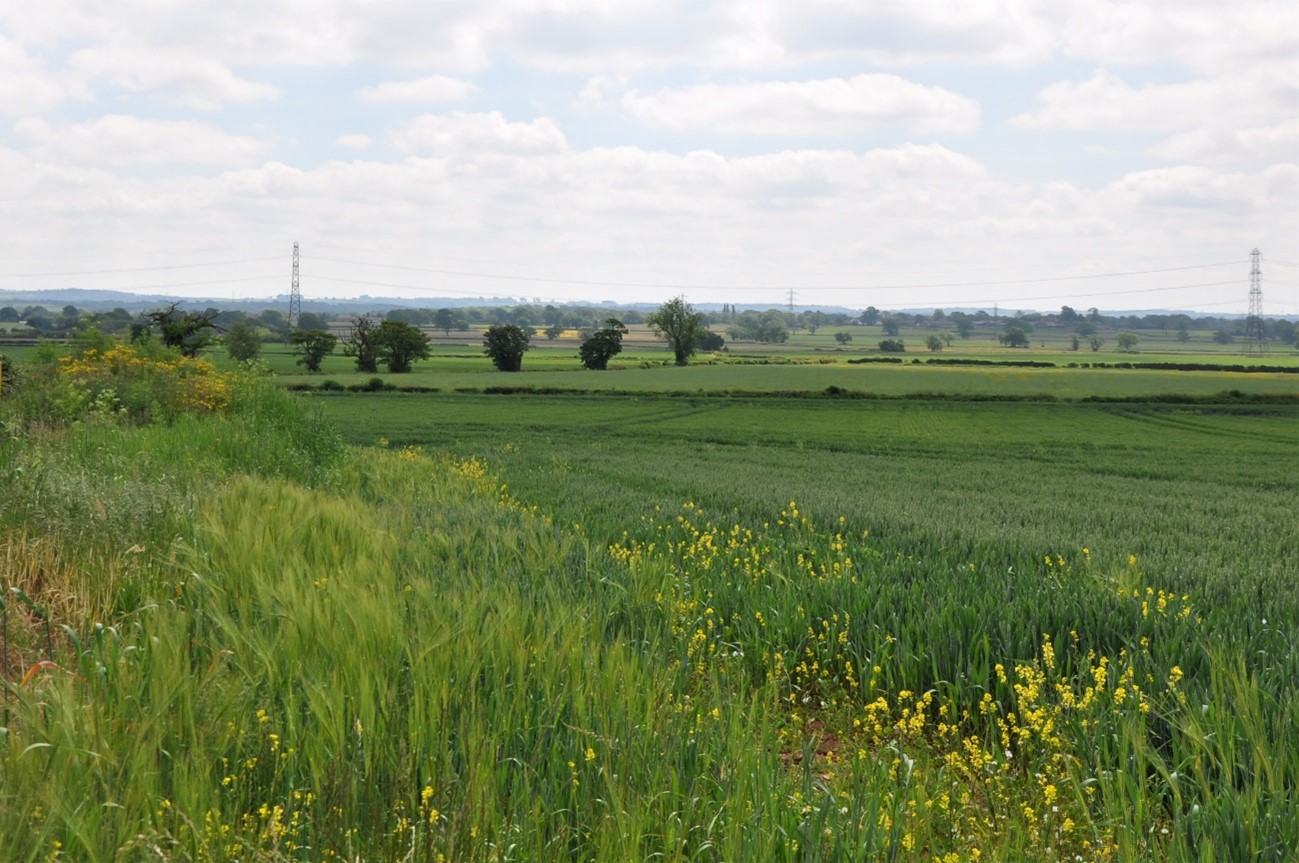
A relatively low-lying area of gently rolling farmland located centrally in South Gloucestershire. Settlements within and surrounding the LCT have a strong influence on the landscape character of this area. Within South Gloucestershire, LCT 4 comprises LCA 8: Yate Vale, LCA 9: Tytherington Plain, LCA 10: Earthcott Vale, as described in the South Gloucestershire LCA SPD (draft for adoption 2024) and shown on the mapping provided.
South Gloucestershire Strategic Blue-Green Infrastructure Corridor G: Wickwar-Iron Acton (Ladden Valley) and Corridor C: Winterbourne-Kendleshire-Yate (River Frome Corridor) covers a large portion of the central and eastern parts of the LCT, predominantly associated with the strategic wetland network and watercourses across the vale. Green Infrastructure Corridor B: Charfield-Alveston-Hallen (Western Scarp/Severn Ridges) covers a small portion of the northwestern part of LCT, predominantly associated with the woodland strategic network on the ridges. Corridors G, C and B form part of a wider strategic GI network that has been identified to protect designated landscape, heritage and ecological sites and features, well as connecting green and blue infrastructure for the benefit of both people and nature. Further detail is provided in the South Gloucestershire GI Corridor Mapping report (draft for adoption 2024).
Existing tree and woodland coverage
This is a sparsely wooded LCT, with woodland cover comprising 1.7% of the total landcover of the Shallow Vale LCT, one of the lowest in the district. Ancient woodland is very limited, accounting for less than 1% of total landcover. Woodland typically occurs in copses and small farm woodlands, Â and as riparian woodland along the River Frome corridor. Trees outside woodland, including occasional hedgerow trees, isolated mature trees, and remnant traditional orchards further contribute to the character of the landscape.
The Tytherington Plain (LCA 9) is an open agricultural landscape with field boundaries interspersed with regular hedgerow trees.
Tree cover around settlement edges helps to assimilate built development into the landscape.
Landscape sensitivities
Landform (including scale and pattern)
- A medium to large-scale landscape comprising the shallow, broad valleys of the Ladden Brook and River Frome.
- The simple, flat to gently rolling topography lying between 50m AOD and 85m AOD, indicates lower sensitivity to new woodland planting.
Field and landcover pattern
- Small, irregular fields in LCA 8 and LCA 10 would be more sensitive to new woodland planting that could mask the existing landscape pattern. Larger, amalgamated regular fields in the north and west (LCA 9) would be more able to accommodate new woodland.
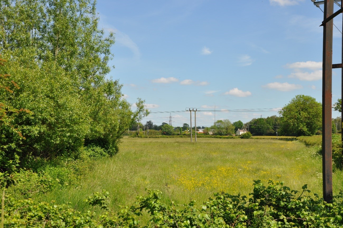
- Existing semi-natural grassland habitats, including floodplain grazing marsh associated with the Ladden Brook and scattered neutral and calcareous grasslands elsewhere, would be sensitive to new woodland planting that could result in the loss of landscape and habitat diversity.
- Existing semi-natural woodland habitats (including Local Wildlife Sites) are scattered across the LCT and could provide opportunities for new woodland planting to enhance habitat connectivity.
- Several fragments of traditional orchard remain across the LCT. New small-scale planting could enhance and reinstate orchards as an important cultural and ecological feature of the landscape, which historically would have been more prevalent across the LCT.
Historic landscape character
- The intact historic field pattern of medieval and 18th/19th century parliamentary enclosures would be sensitive to woodland expansion that could mask the historic landscape pattern.
- Historic settlements with Conservation Areas at Iron Acton, Tytherington and Winterbourne would be sensitive to new woodland planting that could alter their setting or significance.
- Remnant parkland with mature specimen trees at Rangeworthy Court, Acton Court, and Grange Court Farm would be sensitive to new medium and large-scale woodland planting that could mask or detract from the historic integrity of the landscape.
- A limited number of historic assets of national significance including the site of a Roman town and a medieval moated site (both Scheduled Monuments), would be sensitive to woodland planting that could have the potential for physical harm to heritage assets or impact on their setting.
Visual character (including skylines)
- A relatively open landscape, particularly in LCA 9 where low hedges and field boundaries afford views across the landscape. Elsewhere, far reaching views are often limited by the gently undulating landform and mature vegetation.
- Occasional long-distance views across the vale towards Winterbourne and east to the Cotswold Scarp are afforded from open, elevated areas above the Bradley Brook (LCA 10). The landscape would be sensitive to new woodland planting that could screen or enclose these views.
- This low-lying LCT is visually contained by ridges in adjacent LCTs, (several of which are identified as Visually Important Hillsides (VIH)), provide visual containment and form a backdrop to the Shallow Vale LCT. The landscape is sensitive to new woodland planting, which could enclose these key visual relationships.
- Church towers in villages form local landmarks on the skyline, including St Michael’s Church within the Church Lane, Winterbourne Conservation Area. New woodland planting should be carefully designed and sited to avoid screening views of these features.
- Views towards the settlement edges of Yate, Winterbourne, and Frampton Cotterell (outside this LCT) exert an urban influence across the south and south-east of the LCT. New woodland planting could help to integrate these settlements into the landscape.
- The presence of man-made infrastructure, including overhead railway gantries, wind turbines, solar farms, and the M4 motorway, indicate lower sensitivity to new woodland planting which could help to integrate these features into the landscape.
Perceptual and scenic qualities
- A rural landscape with a combination of pleasing features, including historic villages, remnant parklands, scattered traditional orchards, and fields bound by a ditches. Occasional mature hedgerow trees make an important contribution to the tree canopy cover in this LCT.
- The rural character and tranquillity of the LCT is disrupted by the presence of settlement at Yate and Winterbourne, renewable energy developments, and major roads including the M4 and M5 corridors. Additionally, suburban land uses around settlements, including ribbon development, horse paddocks, and golf courses have an urbanising effect. New woodland planting could help to integrate these features into the landscape.
Assessment of landscape sensitivity to tree and woodland planting
Summary
Small and small-medium sized woodland is typical of this landscape and could be accommodated across the LCT. New woodland planting of this scale could reinforce the existing field patterns and complement and extend the existing pattern of occasional copses and small farm woodlands, as well as enhancing the network of hedgerows and hedgerow trees. This size of woodland would be valuable in providing connectivity between existing woodlands. As set out in The Forest of Avon Plan Tree and Woodland Strategy, new small-medium size woodland planting in this LCT could contribute to creating a woodland corridor linking existing woodlands to the woodland complex at Lower Woods (in adjacent LCA 5: Wickwar Ridge and Vale). New small-scale linear woodland planting in appropriate locations along the River Frome and Ladden Brook corridor could enhance riparian habitat connectivity, in line with the aims of the River Frome Reconnected project.
The LCT contains some existing medium-sized woodlands. New planting of this size could provide opportunities to enhance woodland connectivity across the LCT and with adjacent landscapes in the surrounding ridges and valleys. New medium-sized native woodland could link existing small-sized woodlands east of the M5 towards ancient woodland at Corporation Wood (LCA 10). Medium-sized woodlands could also be used to screen settlement edges and solar PV developments.
There are currently no large-sized woodlands within this LCT. The introduction of woodlands of this size would be discordant with the existing woodland pattern and has the potential to mask characteristic landscape features, including the remnant small-scale historic field patterns and important semi-natural grassland habitats.
There are currently no commercial conifer plantations within this LCT. The introduction of this type and size of woodland would be incongruous with the existing landscape pattern and would detract from the distinctive characteristics of the landscape, including the small-scale historic field patterns, semi-natural grassland habitats, and key views afforded across the landscape, including from SVPs.
Any variations in landscape sensitivity
LCA 9: Tytherington Plain would be particularly sensitive to new medium-large size woodland due to its relatively open character, with views east across the open plain and towards the Wickwar Ridge, extensive areas of floodplain grazing marsh priority habitat. While this landscape could accommodate new small and small-medium sized woodlands, new planting should be designed to maintain the open character of the landscape.
| Criteria | Small size native woodlands and trees outside woodlands (≤5ha) | Small-medium size native woodlands (>5 to 15ha) | Medium size native or mixed woodlands (>15 to 30ha) | Large size native or mixed woodlands (>30ha) | Medium-large size conifer plantation (>15ha) |
| Landform (including scale and pattern) | Low | Low-Moderate | Moderate | Moderate-High | High |
| Field and landcover pattern | Low | Low-Moderate | Moderate | Moderate-High | High |
| Historic landscape character | Low | Low-Moderate | Low-Moderate | Moderate-High | High |
| Visual character (including skylines) | Low | Low | Low-Moderate | Moderate | High |
| Perceptual and scenic qualities | Low | Low | Low | Moderate | High |
| Overall score | Low | Low-Moderate | Moderate | Moderate-High | High |
Tree and Woodland planting guidance
- Design new woodland to reflect the small-medium landform scale and align along existing contours of the gently sloping river valleys.
- Enhance and manage riparian tree planting in appropriate locations along the River Frome corridor to help alleviate flooding and enhance biodiversity value, in line with the aims of the South Gloucestershire River Frome Reconnected project. Seek opportunities to extend and link riparian woodland planting along the Ladden Brook and Bradley Brook valleys to enhance ecological connectivity.
- Avoid siting woodland across multiple fields which would mask the remnant small-scale historic field patterns. Seek opportunities to integrate new hedgerow trees and small copses within the historic field framework.
- Manage remnant parkland with mature specimen trees at Rangeworthy Court, Acton Court, Yate Court and Grange Court Farm and encourage new planting to reinforce the parkland character and to enhance their heritage, landscape and biodiversity value.
- Protect and enhance the network of hedgerows and hedgerow trees, planting new ones where they are absent, to reinforce the characteristic field pattern and improve ecological connectivity, in line with the aims of the South Gloucestershire Common Connections project.
- Promote new small-medium-scale farm woodlands, where this supports farm diversification and fits with the existing farm woodland landscape.
- Manage the existing mosaic of semi-natural grasslands and woodland habitats, and enhance ecological connectivity through creation of wildlife corridors such as hedgerow trees and riparian woodland.
- Protect and enhance remaining traditional orchards and reinstate them where they have declined or been lost from the landscape, using locally distinctive species.
- Preserve and enhance the landscape setting of Conservation Areas at Iron Acton, Tytherington and Winterbourne , together with key views to and from key features, including listed buildings. Ensure new woodland planting does not detract from their landscape setting, or enclose key views to and from the settlements.
- Encourage and enhance small-scale woodland planting in proximity to industrial and residential development (e.g. around Yate and along the urban edge of Winterbourne) to minimise the influence of settlement edges on the wider rural landscape.
- Utilise new small-scale woodland planting to screen and integrate renewable energy developments into the landscape, including new solar PV and battery storage schemes around Iron Acton substation.
- Refer to LCA-specific guidance as set out in the Forest of Avon Plan.
- Any new planting should follow principles of good design, as set out in the UK Forestry Standard.